FREE
Using PARTIMAP is completely free, with no hidden costs and no subscription.
MAP-BASED
You can tie your questions to specific locations, so that the answers also appear on a map.
SURVEY
Collect opinions with easy-to-use, customizable surveys.
Ways to use it
See what PARTIMAP can do!
PARTIMAP can be used in many areas, from community planning through resident consultations to problem mapping and idea gathering. Using the demo surveys below, you can try out the platform's most important features and gather inspiration for your own project.
Discover how map-based questions can help you collect local knowledge, map community needs or ask for feedback about a development. The examples showcase different ways of using it, so you can more easily find how to apply PARTIMAP to achieve your own goals.
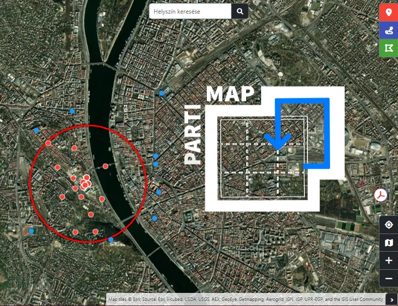
This demo survey briefly shows how PARTIMAP can be used to create surveys on a wide range of topics. It lets you try out several question types and map features, so you can see how text, multiple-choice, rating and map-based answers are collected and displayed in a survey. With PARTIMAP, local governments, civil society organisations, communities and other organisations can easily create their own surveys and participation processes, tailored to their needs.
View →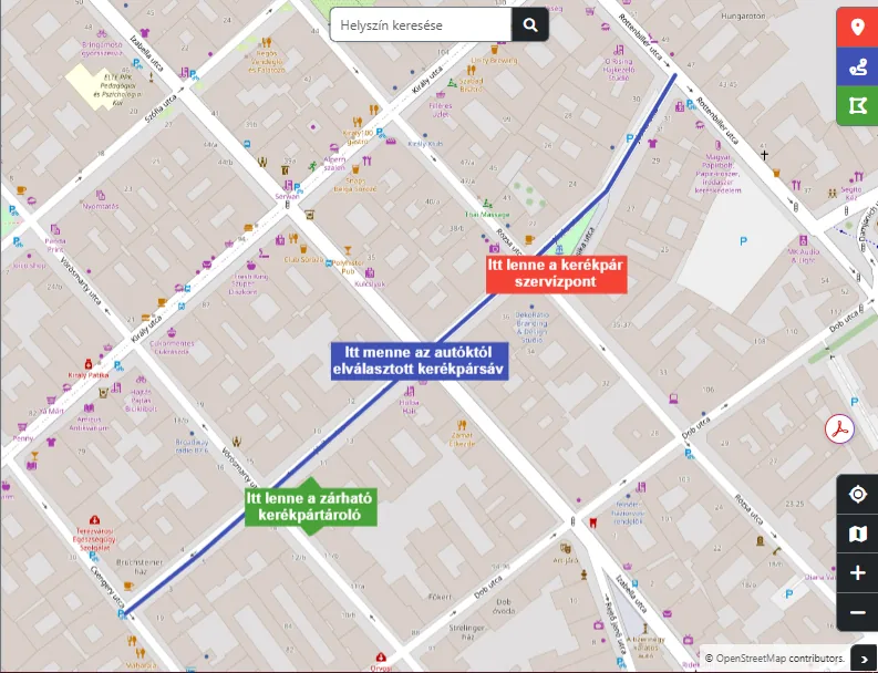
This demo survey shows how to assess the cycling habits, experiences and opinions of local people about cycling. Respondents can mark dangerous or hard-to-use road sections on the map and make suggestions for improving cycling infrastructure.
View →More demo surveys are coming soon!
Why use it?
PARTIMAP makes planning and running participatory processes simpler and more effective. With map-based surveys you can not only collect opinions, but also understand which locations, problems or development opportunities respondents link their observations to.
The platform lets you reach a wider audience, collect structured data and present the results in an easily analysable form. Whether it's community planning, resident consultation, research or mapping local problems, PARTIMAP helps make decisions more informed, transparent and inclusive.

Easy to edit
The PARTIMAP interface is intuitive and easy to use, so you can quickly create and edit map-based surveys even without technical knowledge.

Free and open source
The application is a free, open-source solution that requires no subscription or licence fee.

Customizable design
The look of the surveys and maps can be flexibly adjusted to match the visual identity, theme or target audience of a given project.

Available in multiple languages
PARTIMAP has a multilingual interface, making it suitable for engaging diverse linguistic and international audiences.

Interoperable with other platforms
PARTIMAP can be easily embedded in websites and works well with other digital tools, so it can be simply integrated into existing online platforms.

Under continuous development
PARTIMAP is a living, continuously evolving application: we regularly improve existing features, test new solutions and keep developing the interface based on user feedback.
Stuck?
We can help!
For using PARTIMAP we provide detailed help that guides you step by step, from filling in a survey all the way through building your own survey and analysing the data — whether it's about technical settings or methodological questions.
How to create a PARTIMAP?
We show you step by step how to gather your data and turn it into a clear, eye-catching map-based survey that gives a real picture of your respondents.
READ MORE!
How to write a survey?
We help you formulate clear, targeted questions so that the answers provide genuinely useful and reliable information.
READ MORE!
How to analyze data?
We show you how to interpret the data you receive, how to spot patterns and how to draw practical conclusions from them.
READ MORE!Some statistics
More and more people are using PARTIMAP as a tool for community engagement, in research, for thesis work or in local government work: the application has by now become a defining tool of participatory data collection.
NUMBER OF SURVEYS
This many unique surveys have been created on the PARTIMAP platform by registered users.
SUBMITTED MAP ELEMENTS
This many locations, points or areas have been marked by respondents answering map-based questions.
NUMBER OF RESPONSES
This many times surveys made with PARTIMAP have been completed.

Success stories
We are proud of the national and international projects that have been realised with the help of PARTIMAP: on this interactive map you can discover exciting initiatives that not only showcase the results achieved so far, but can also spark new ideas for mapping and data-driven thinking.
News
Discover PARTIMAP's latest developments, inspiring projects and the practical applications of community mapping. In our news we regularly report on our updates and professional experiences.
Our latest developments
PARTIMAP's latest developments make creating map-based surveys even simpler and more flexible. New features include quiz mode, surveys that can be embedded in websites, more detailed statistical reports, and the ability to copy and transfer projects. Conditional questions, map worksheets, and multilingual project management have also been improved. With these new tools you can collect location-based opinions and data faster and more effectively. Further additions are also in the works, including new question types and GPS point marking.
READ MORE!Field mapping with PARTIMAP
PARTIMAP can be used not only for resident surveys but also for on-site data collection and mapping. Read how we applied the method in the study of Piac Street in Debrecen, where volunteers recorded several hundred commercial premises in the field. We processed the collected information using a map and then complemented the research with a resident survey. The example clearly shows that PARTIMAP is equally suited to objective on-site data capture and community opinion gathering.
READ MORE!How does a PARTIMAP project work? Community mapping step by step
Within the "Monitoring Together!" project, K-Monitor partnered with three civil society organisations to carry out community mapping and resident opinion-gathering projects in Debrecen, Gárdony and Veresegyház. The aim was to help local communities back their development proposals with data and resident feedback, especially on green spaces, transport and the use of public areas. During the project participants used PARTIMAP to create map-based surveys, collected data, then analysed and presented the results to local decision-makers. The programme also offered a practical guide on how to effectively apply community mapping and participatory data collection to local issues.
READ MORE!Our clients
PARTIMAP has already been successfully used by numerous national and international organisations: alongside local community actors, local governments and civil society organisations, businesses and companies also use it for decision support, research and strategic planning.











The development is carried out as part of the Participatory Mapping in Cohesion Policy in Hungary (PARTIMAP) project, supported by the European Commission (DG Regio). Further development of the tool was supported by the Prague office of the Heinrich Böll Foundation.